Euphrates River
Context: A recent study published in Nature Geoscience has used seismic imaging and geological evidence to explain the origins and evolutionary history of the Euphrates River.
Prelims :
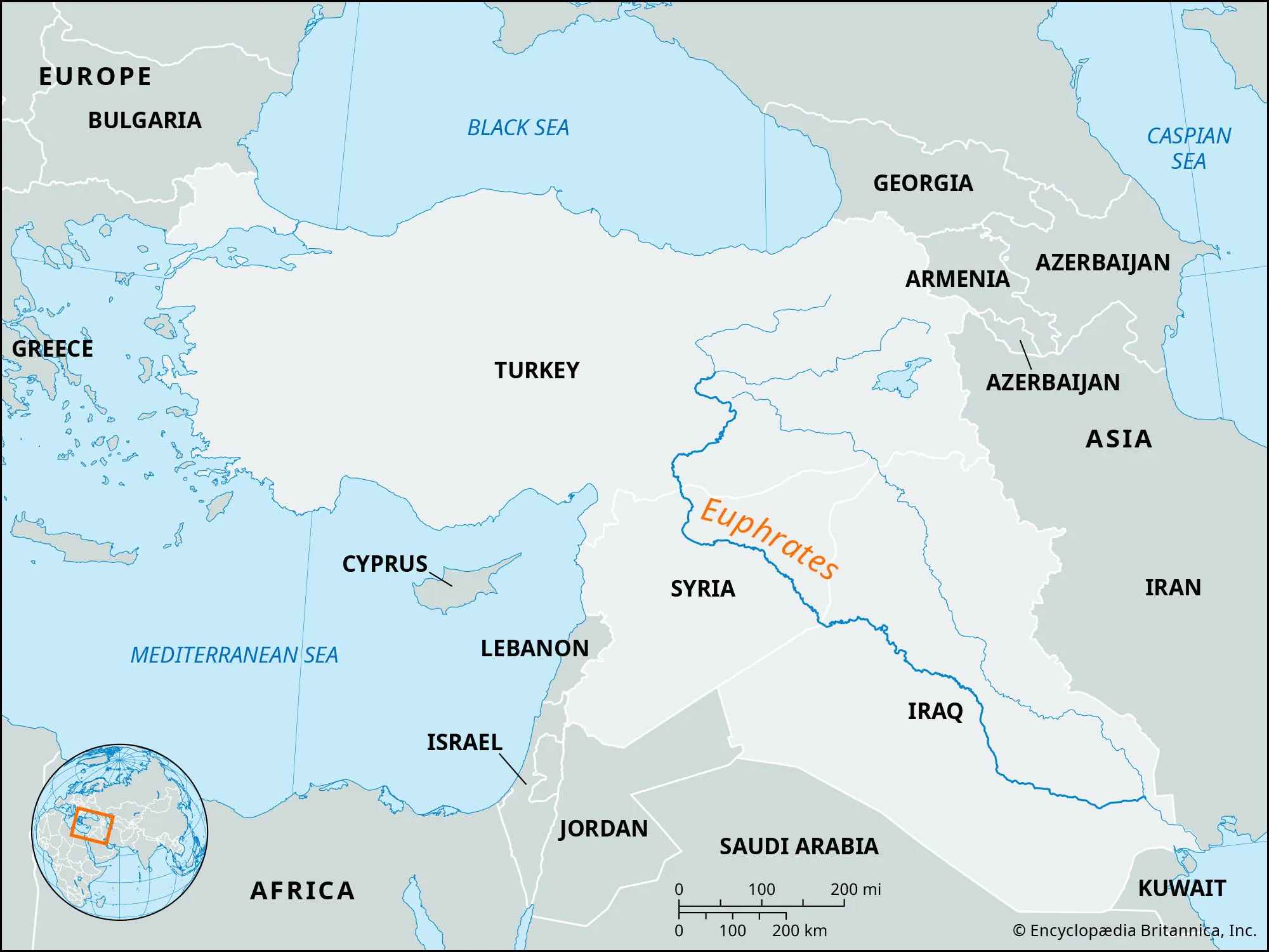
- The Euphrates is the longest river in Southwest Asia and holds immense historical importance. Along with the Tigris River, it forms the heartland of ancient Mesopotamia.
- Source Region: The river begins in the Taurus Mountains of eastern Turkey, where its two principal headstreams, the Karasu and Murat rivers, converge to form the Euphrates.
- Course: From its mountainous source, the river flows southeastward across approximately 2,800 km (1,700 miles), traversing three present-day countries:
- Turkey: The upper reaches originate and gather water from the highlands of Eastern Anatolia.
- Syria: The river passes through vast arid and semi-arid landscapes in the northern and eastern parts of the country.
- Iraq: It continues through broad alluvial plains before reaching southern Iraq.
- Termination: Near Basra, the Euphrates merges with the Tigris River to create the Shatt al-Arab waterway, which eventually drains into the Persian Gulf.
Key Geological Features:
- Formation Through Tectonic Activity: Geological uplift in Eastern Anatolia altered the courses of ancient rivers, ultimately leading to the joining of the Murat and Karasu rivers and the formation of the modern Euphrates.
- Evidence from Seismic Imaging: Detailed 2D and 3D seismic surveys uncovered buried river channels and sediment deposits, enabling researchers to reconstruct nearly five million years of the river’s geological evolution.
- Much Larger Ancient Flows: Geological records indicate that prehistoric Euphrates systems transported significantly greater volumes of water than the present river, with discharge levels exceeding those of the modern Nile.
- Development of Fertile Plains: Sediments carried from the Anatolian highlands accumulated over time in the Persian Gulf basin, gradually creating the rich alluvial landscapes of Mesopotamia.